 While we were in Phoenix, AZ, for the month of November we took several side trips exploring the area. We drove scenic route 89 from Wickenburg to Prescott, along a beautiful winding road with great views of the mountains and valleys as we climbed higher in elevation. Prescott is at 5,367ft and it was much colder than Phoenix. We went shopping on Whiskey Row for warmer clothes. The main street was originally known for the establishment of many saloons, gambling parlors, opium dens, and houses of prostitution. The town-site of Prescott was officially founded in 1864, as the Territorial Capital of Arizona. Many of the old wooden buildings on Whiskey Row were destroyed in “The Great Fire” of July, 1900, and replaced with more permanent concrete, brick, and stone buildings which are still intact today and give the town a very old-western appeal. While shopping we were told to visit the Superstition Meadery, founded in 2012. Needless to say neither of us had tried Mead before so we were ready to sample it. Their mission at the Meadery is “To Reintroduce the World’s Oldest Fermented Beverage to Mankind”, and we wanted to sample the range of craft beverages, many of which are the top rated in the world. Oak barrel aging is the secret to many of the products they make at Superstition Meadery. The flight of Mead and Cider we tasted was excellent and we even bought a bottle to go. We stayed the night at the historic Hassayampa Inn, opened in 1927, with on-site bar and restaurant and very stylish rooms. We went for dinner at the El Gato Azul, a friendly, quirky little restaurant in walking distance from the Inn.
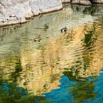
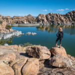
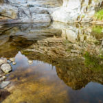
The next day we drove to Watson Lake and the Granite Dells, just outside of Prescott. Watson is a man-made lake created in April 1915 with the completion of the Granite Creek dam. We walked the trail around the lake enjoying the granite boulders, creating spectacular photo opportunities, particularly in the calm water with reflections. The Granite Dells are so photogenic it has seen its share of Western movie shoots. Between 1913-1915, over a hundred silent westerns were filmed in Prescott and the surrounding area. Nestled along the Granite Dells, Watson Lake makes for one of the most picturesque scenes in Prescott. Click on thumbnail to view images
Prescott
Jerome
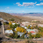
Only 25 miles from Prescott is the town of Jerome, once known as the “Wickedest town in the West”. Jerome was born a copper mining camp, growing into a roaring mining community. Founded in 1876, Jerome was at one time the fourth largest city in Arizona, a population of 15,00 in the 1920’s. It became a ghost town in 1952 when the copper mining industry abandoned the town, inhabited by less than 200 people. Efforts to save the town from oblivion succeeded when residents turned to tourism and retail sales. Jerome became a National Historic Landmark in 1967. We visited the Mine Museum devoted to its mining history and had lunch in the Asylum Restaurant at the Jerome Grand Hotel on the hill, at 5,240 above sea level. The Hotel was originally constructed in 1926 under the name United Verde Hospital, a state-of-the-art medical facility. The Hospital closed in 1950, as the mining operations began shutting down, and stood unused for the next 44 years. Opening for business in 1996, it was renamed the Jerome Grand Hotel; keeping with design reminiscent of the time, the Hotel brings back that feeling of grandeur from antique furnishings to the original 1926 Otis elevator, and the 1926 Kewannee Boiler to provide steam heat. It is worth a visit and maybe an overnight stay in one of the haunted guest rooms. Click on thumbnail to view images
Tonto Natural Bridge State Park
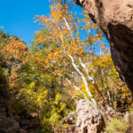
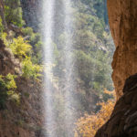
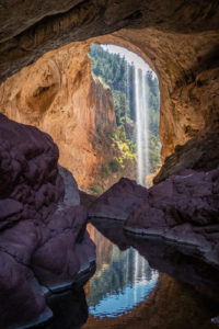
The next day we drove north of the small town of Payson to Tonto Natural Bridge, a natural arch, that is believed to be the largest natural travertine bridge in the world. It was discovered in 1877 by David Gowan, a Scotsman, who was hiding from hostile Apache tribe members. He persuaded his family to emigrate and live there until 1926 when he died. The family members lived near by until 1948, and their lodge survives to this day. We stopped by the Visitor Center inside the historic Goodfellow Lodge, and discovered that the Gowan Trail to the observation deck in the creek bottom was closed for repairs, so we did the Pine Creek Trail and the Waterfall Trail to the Natural Bridge and Waterfall instead. Tonto Natural Bridge stands over a 400-foot-long tunnel that measures 150 feet at its widest point and a height of 183 feet and the length of the tunnel is 393 feet. Pine Creek Trail is about 1/2 mile long in the creek bottom, it was rocky and steep with wooden stairs not recommended for some hikers. We had to scramble through the boulders along the creek following the arrows to get to the best view of the Natural Bridge and Waterfall. Luckily it was not crowded so we had plenty of time o explore and take photos. When we returned to the Visitor Center there was a squadron of javelinas hanging out on the grassy lawn. Most of the natural bridges found throughout the world are made of sandstone or limestone, making this particular bridge very unique and special. We were awestruck at our first glimpse of the grandeur of the Natural Bridge, it was definitely a visually stimulating experience. Click on thumbnail to view images
Sabino Canyon Recreation Area, Tucson, AZ
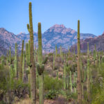
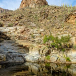
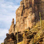
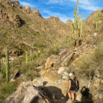
Our last outing was to hike in Sabino Canyon, a significant canyon located in the Santa Catalina Mountains north of Tucson surrounded by the Coronado National Forest. We stopped in at the Visitor Center to pick up a map of the area, before heading out to the Bear Canyon Trail. We crossed undulating, bushy land for 1.7 miles, the trail is stoney, mostly level, and not too difficult, except when we crossed some of the seven creek crossings. The canyon sides are steep and jagged, with many desert plants: ocotillo, saguaro, cholla, prickly pear, and palo verde. Then we started to climb steadily up the ravine and up Bear Canyon for about 3 miles, where we descended to a rock plateau at the base of the Seven Falls. This is the most photogenic feature in the canyon, where it gains 200 feet in elevation via a series of water-polished chutes and terraces. When flowing, the stream forms many pools and cascades over the seven main waterfalls. There was not a lot of water flowing when we were there in November but it was still a beautiful sight. We ate lunch on the Trail before heading back to the visitor center, we didn’t use the shuttle back. Click on thumbnail to view images


