
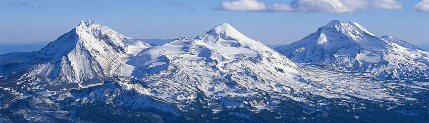
Our next adventure began in the charming town of Sisters, Oregon, nestled in the shadow of the iconic Three Sisters peaks. This picturesque mountain town, with its rich Western heritage and stunning views, instantly captured our hearts. After a scenic drive, we arrived at the Sisters Garden RV Resort, a beautiful, peaceful spot just outside…
Category: Oregon
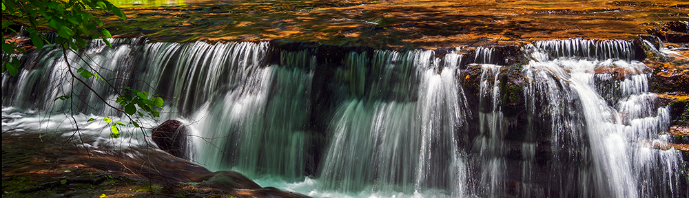
Silver Falls State Park and Sahalie Falls
Today, June 16, we visited Silver Falls State Park, located 20 miles east-southeast of Salem and 1 1/2 hour drive from Eugene. The Park is the crown jewel of the Oregon State Parks system, being both Oregon’s largest State Park and boasting one of America’s most impressive waterfall day-hikes, the Trail of Ten Falls, a…
Oregon Coast
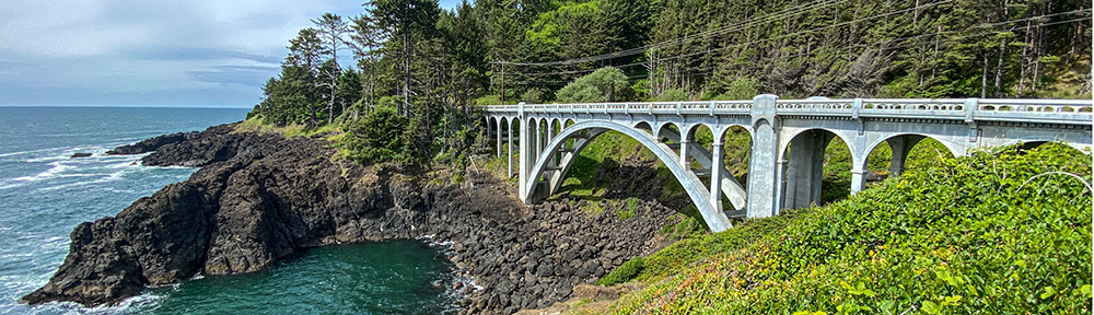
On June 3, 2021, we took our RV to the Guaranty RV paint shop to give the roof a new look. We booked into the River House Inn in Florence on the Oregon Coast for three nights. We have a nice room on the second floor looking out across the Suislaw River and Bridge and…
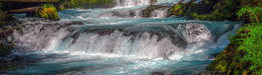
Oregon Waterfalls near Eugene OR
On June 1, 2021, we took RSHRPA in for repairs and a paint job at Guaranty RV in Junction City, Oregon, and went on a day trip in the Jeep to Sweet Creek Falls, one hour drive west of Eugene near Mapleton. It was a beautiful hike through dense moss covered trees for 2.2 miles,…
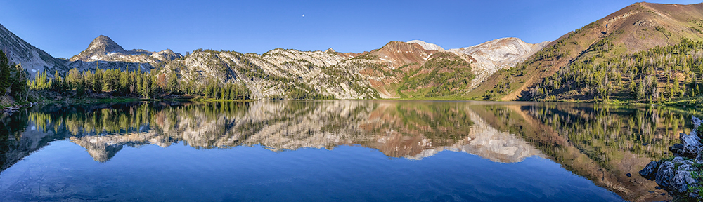
Eagle Cap Wilderness
The Eagle Cap Wilderness was established in 1940 and lies in the heart of the Wallowa Mountains in northeastern Oregon, with a total of 359,991 acres. It was used as hunting grounds for bighorn sheep and deer, and was the summer home to the Joseph Band of the Nez Perce tribe, who moved into the…
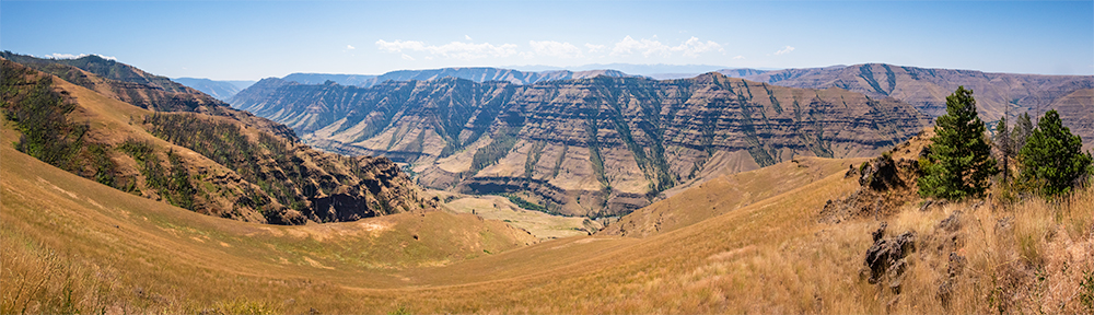
Joseph Oregon
On August 3rd we left Coeur d’Alene and headed for Joseph, Oregon, with an overnight stop in Clarkston, WA, at the beautiful Granite Lake RV Park situated on the Snake River. The next morning we drove to Joseph along a very narrow, winding road over Rattlesnake Pass to the Wallowa River RV Park in Wallowa,…
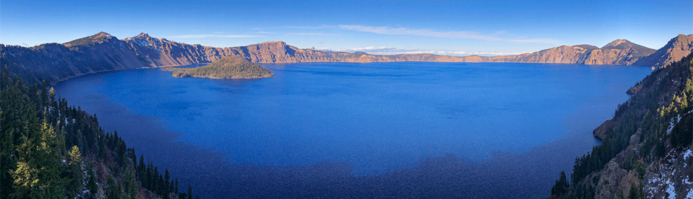
Crater Lake, Oregon
On October 26th, 2019, while staying at Seven Feathers RV Park in Canyonville, OR, we drove over to Crater Lake National Park for the day. Visiting this iconic Park for the second time was still a special treat, to see that brilliant blue color of the lake is still so impressive. There wasn’t as much…

Multnomah Falls, Oregon
After leaving Bellingham on October 18th, we stopped in Portland, Oregon, where we stayed at the Columbia River RV Park situated on the Columbia River. We had not stopped in Portland before and wanted to explore the area. We visited Multnomah Falls at the Columbia River Gorge National Scenic Area, it is the tallest waterfall…

Oregon Coast
We finally left San Diego on June 15th heading north to the Oregon Coast where we had booked into the Sea Perch RV Resort for two nights, located near Yachats, We explored the beaches near the Park, first drove to get a beautiful view of Heceta Beach at the viewpoint looking across to the Heceta…

Bend Oregon
Our next stop was at Bend Sisters Garden RV Resort near Sisters, Oregon. We drove to the Cascade Lakes Scenic Byway past Mt Bachelor to Sparks Lake where we had great views of South Sister across the Lake. We also stopped at Devils Lake and walked around the lake, a beautiful shallow lake, with waters…