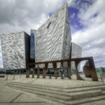
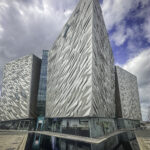
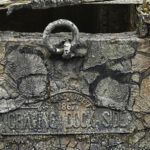
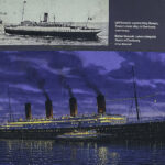
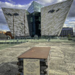
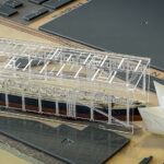
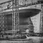
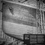
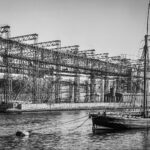
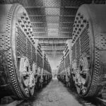
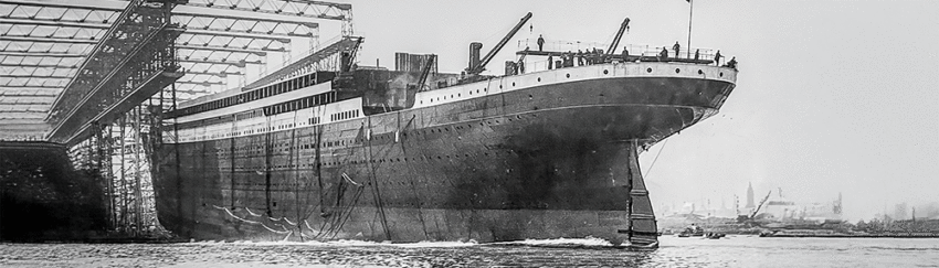
The museum reveals just how extraordinary the ship was for its time. Built by Harland and Wolff for the White Star Line, Titanic was the largest moving man-made object in the world when she entered service in 1912. She measured approximately 882 feet long, displaced over 46,000 tons, and stood more than 11 stories high from keel to the top of her funnels. Powered by a combination of coal-fired boilers, two massive reciprocating steam engines, and a central steam turbine, Titanic could reach speeds of about 23 knots, impressive for a ship of her size.
The ship was designed with unprecedented luxury and comfort, particularly for first-class passengers. Amenities included a grand staircase topped with a glass dome, a swimming pool, Turkish baths, electric elevators, and opulent dining salons that rivaled the finest hotels in Europe. At the same time, Titanic reflected the rigid social divisions of the era, with clearly separated accommodations for first, second, and 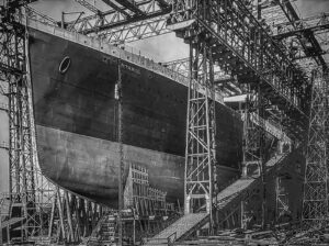 third-class passengers—each designed to different standards but all considered advanced for their time.
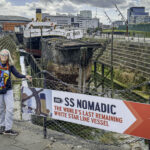
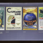
Titanic was operated by the White Star Line, a prestigious British shipping company known less for speed and more for comfort, reliability, and elegance. In contrast to rivals such as Cunard, White Star emphasized spacious interiors and refined service over record-breaking crossings. Titanic was the second of three Olympic-class liners—the others being Olympic and Britannic—intended to dominate transatlantic travel and symbolize British industrial power.
Despite being equipped with advanced safety features for the era, including watertight compartments, Titanic famously carried too few lifeboats, a decision shaped by outdated maritime regulations and a widespread belief in the ship’s near-invincibility. Her tragic sinking on her maiden voyage transformed maritime safety forever, leading to sweeping changes in international regulations, lifeboat requirements, and radio monitoring at sea.
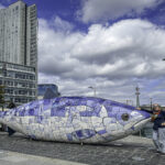
Today, the story of Titanic—its ambition, engineering brilliance, and human cost—remains inseparable from Belfast’s identity, standing as both a monument to industrial achievement and a sobering reminder of the limits of technology and human confidence. Click on thumbnail to view images
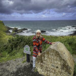
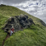
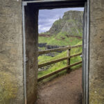
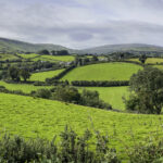
From Belfast, we set out in our rental car and drove north, passing through the village of Bushmills on our way to one of Ireland’s greatest natural wonders—the Giant’s Causeway. The drive itself was a pleasure, with rolling green countryside giving way to dramatic coastal views as the Atlantic came into sight.
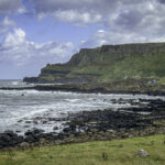
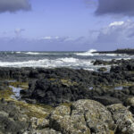
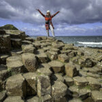
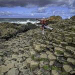
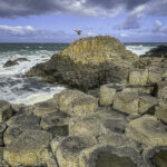
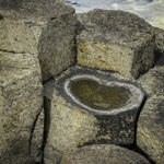
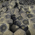
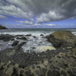
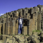
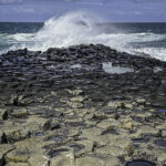
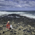
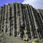
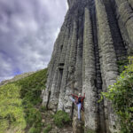
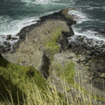
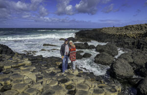 The Giant’s Causeway is a surreal and mesmerizing landscape of more than 40,000 interlocking basalt columns, most of them perfectly hexagonal, stepping down into the sea like a vast natural staircase. Some columns rise several meters high, while others form natural pathways that disappear beneath the waves. Formed around 60 million years ago, the columns are the result of intense volcanic activity, when molten lava flowed across the land and cooled slowly, contracting and cracking into remarkably regular geometric shapes. The consistency and scale of these formations are astonishing,
 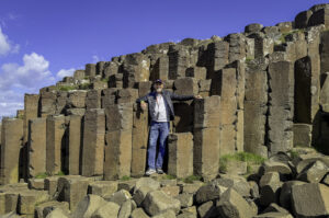 making the Causeway one of the finest and most complete examples of columnar basalt anywhere in the world and earning it UNESCO World Heritage status.
Geology tells one story, but local legend tells another. According to Irish folklore, the Causeway was built by the giant Finn McCool as a stone bridge to Scotland so he could confront his rival, Benandonner. Variations of the tale weave humor and cleverness into the landscape, turning natural rock formations into the frozen remnants of a mythical rivalry. The interplay between scientific explanation and ancient storytelling adds a rich layer of meaning to the experience, allowing visitors to engage with the site both intellectually and imaginatively.
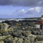
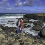
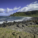
Standing among the columns, with Atlantic waves crashing against the rocks, seabirds wheeling overhead, and the wind carrying the scent of salt and sea spray, the Giant’s Causeway feels both timeless and elemental. It is a place where deep geological history, enduring myth, and the raw power of nature converge—an unforgettable encounter with the ancient forces that shaped this dramatic coastline. Click on thumbnail to view images
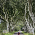
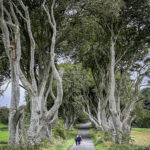
From the Giant’s Causeway, we headed a short distance inland to visit another iconic Northern Irish landmark—the Dark Hedges, made world-famous by its 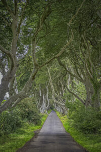 appearance in the television series Game of Thrones.
The Dark Hedges form a hauntingly beautiful tunnel of intertwined beech trees lining a narrow country lane near the village of Armoy. The avenue was planted in the 18th century by the Stuart family of Gracehill House, designed to create a grand and memorable approach for visitors arriving at their estate. Over generations, the trees matured and gradually leaned inward, their tall trunks and sweeping branches arching together overhead to form a natural corridor that feels both elegant and quietly dramatic.
Time and weather have only deepened the hedges’ character. Gnarled trunks, exposed roots twisting through the earth, and dappled light filtering through the canopy create an almost otherworldly atmosphere, especially on misty or overcast days when the road seems to dissolve into shadow. Long before television fame, local folklore surrounded the site, with legends of spirits—most famously the Grey Lady—said to drift silently among the trees at dusk, adding to the sense of mystery that lingers here.
Its use as the Kingsroad in Game of Thrones brought worldwide attention, transforming a once-quiet rural lane into one of Northern Ireland’s most photographed locations. Yet despite the attention, standing beneath the towering beeches still feels intimate and timeless—a place where history, nature, and storytelling merge into a scene that stays with you long after you leave.Click on thumbnail to view images
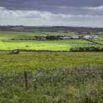
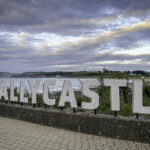
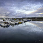
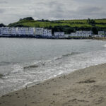
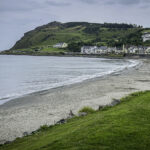
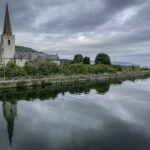
From the Dark Hedges, we drove east to the coastal town of Ballycastle, where we spent the night. Ballycastle has long been an important settlement along the Antrim Coast, with roots stretching back to early Christian times. Its name derives from a medieval castle once associated with the MacDonnell clan, powerful lords of this part of Ulster. Over the centuries, Ballycastle developed as a small harbor town, serving fishermen, farmers, and traders moving goods along the coast and across the narrow 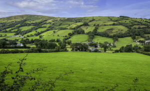 waters to Rathlin Island and western Scotland. In the 18th and 19th centuries, the town expanded through coal mining, lime production, and maritime trade, traces of which remain in its harbor and surrounding landscape. Today, Ballycastle retains a relaxed seaside character, shaped by its long relationship with the sea and the fertile countryside that surrounds it.
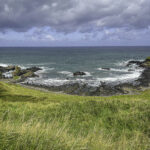
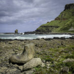
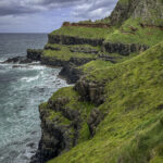
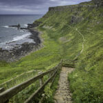
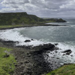
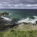
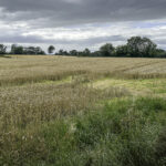
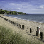
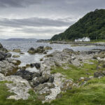
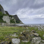
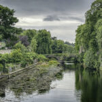
From Ballycastle, we headed south along one of Northern Ireland’s most scenic coastal routes, following a shoreline where rugged seascapes meet lush green hills. This stretch of coast has been inhabited for millennia, its sheltered bays and fertile land attracting early settlers, monks, and later Norman and Gaelic clans. The road passes through landscapes that feel timeless—fields divided by stone walls, small villages clustered near the shore, and headlands offering sweeping views across the North Channel.
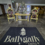
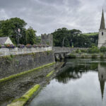
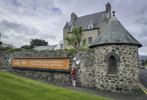 Our journey brought us to Ballygally, where we settled in for several days of rest and relaxation at the historic Ballygally Castle Hotel. Ballygally Castle was built in 1625 by Sir John Shaw, one of the early Scottish settlers who arrived during the Plantation of Ulster, a period that profoundly reshaped the region’s population and land ownership. The castle’s fortified design reflects the unsettled times in which it was constructed, when defensive structures were essential along this contested coastline.
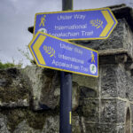
Ballygally also lies along the route of the International Appalachian Trail, which traces ancient geological connections between Ireland, Scotland, and North America. This felt like a small moment of foreshadowing, especially since we were planning to meet one of Patty’s Appalachian Trail hiking partner, Terri, in Dublin, with whom she thru hiked the AT trail in 2001.
The presence of the trail underscores the area’s deep natural and cultural links across the North Atlantic and adds another layer of meaning to this storied coastline. Set directly on the shoreline, with waves breaking just beyond its walls, Ballygally Castle provided a peaceful and atmospheric base—an ideal place to slow down, reflect, and enjoy the enduring beauty and layered history of Northern Ireland’s coast. Click on thumbnail to view images

 Scotland into a city shaped by the sea. After checking into the AC Hotel Belfast, we set out to explore a place whose story blends industrial might, resilience, and renewal.


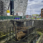
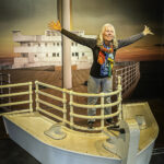
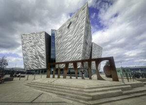 displays, recreated interiors, and personal accounts bring the era vividly to life, while the final galleries explore the wreck’s discovery and the Titanic’s enduring legacy.