The Discovery Coast Circle Tour: Part 1
 Tsawwassen Ferry Terminal to Port Hardy:
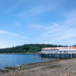
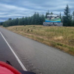
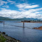
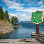
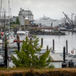
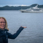
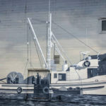
This summer we decided to take time to explore BC, our beautiful province. The best way to see all that British Columbia has to offer is to take the Discovery Coast Circle Tour, roughly 1400 km (870 mi) of driving and 16 hours of sailing. We left Vancouver from the Tsawwassen Ferry Terminal and stopped at Salt Spring Island to visit my sister then took the Vesuvius Ferry to Crofton where we began our drive north on Vancouver Island. We stopped for lunch in Sayward, located about 1 mile inland from Kelsey Bay. The village is named after William Parsons Sayward, a successful lumber merchant from Victoria, who came here in 1858 from California. We found a little gem of a cafe in Sayward, the Straits View Cafe, with a view of Johnstone Strait, and excellent food. I went wide and had fried BC shrimp for lunch and we shared one of their famous homemade pies for dessert. After lunch we wandered down to the Kelsey Bay wharf, once the southern terminus for the B.C. Ferries Inside Passage route until 1978, when Highway 19 was extended north to Port Hardy. Now it is a convenient stopping point for sport fishing and eco-tourism.
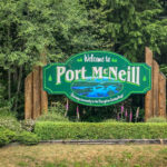
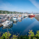
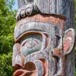
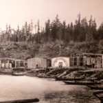
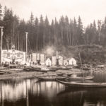
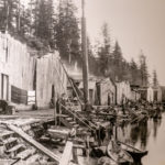
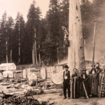
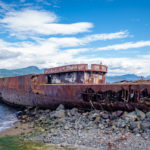
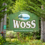
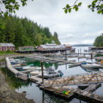
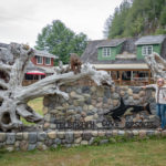
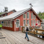
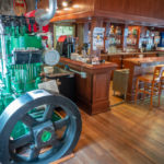
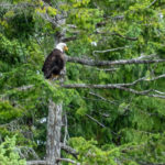
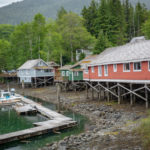
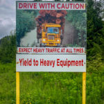
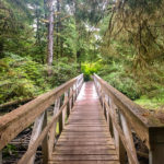
Then we drove into the old logging town of Woss in the Nimpkish Valley, a population 200. Until the mid 1960s Woss was only accessible by rail and most of the loggers were housed in bunkhouses heated with wood-fired steam. We saw one of the original steam powered locomotives currently a working tourist attraction. We took a reminiscent drive to Hidden Cove where we had stayed in the Lodge years ago to go kayaking, and left from Telegraph Cove in the kayaks to paddle to Robson Bight. Of course, our next stop was Telegraph Cove, a small community of about 20 inhabitants, a former fishing and cannery village that has become a tourist attraction. The community grew out of a one-room station at the northern terminus of the Campbell River telegraph line by the federal government in 1911-12. Finally arriving at Port Hardy, our destination for two nights. It is a small fishing community, and is also proud of its First Nations heritage, art galleries and totems. We stayed at the Glen Lyon Hotel because of its proximity to the Ferry terminal. Click on thumbnail to view images


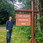
Cape Scott Provincial Park
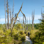
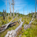
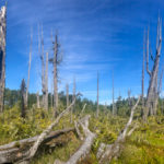
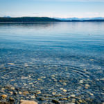
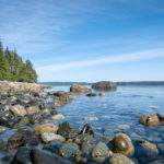
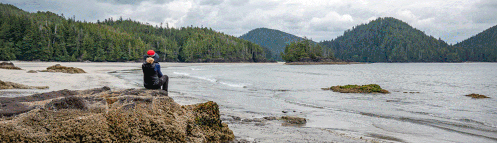
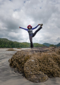
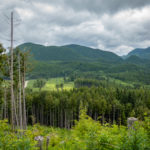
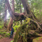
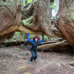
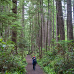
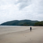
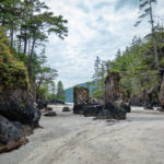
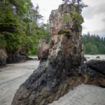
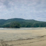
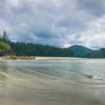
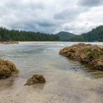
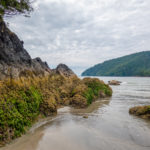
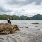
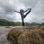
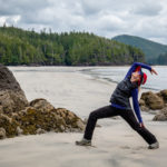
The next day we drove out to Cape Scott Provincial Park, a truly magnificent area of rugged coastal wilderness, established on May 18, 1973. We drove 64 km along an active dirt logging road from Port Hardy to reach Cape Scott. We hiked 2.5 km (1.6 mi ) from the trailhead through old growth spruce and hemlock trees, out to San Josef Bay with spectacular Pacific Ocean vistas along the well-maintained gravel, sometimes muddy trail, which ends at the sandy shore of San Josef Bay. As we arrived at San Josef Bay, we were in awe of the sheer vastness of the vacant beach, there was not a soul anywhere. We walked along the expansive waterfront about a mile to the sea stacks with the trees growing atop them despite little soil. These amazing sea stacks are magnificent and huge, developed over time from water surging through the sandy passages at high tide slowly eroding the softer rock. So impressive are the sea stacks, the tidal pools and the sheer solitude of the beach, no wonder it is called Vancouver Island’s most beautiful beach.

Alert Bay
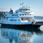
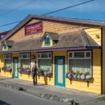
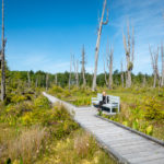
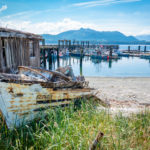
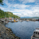
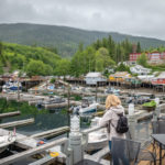
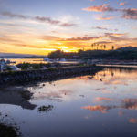
Today we took the ferry from Port McNeill to the Village of Alert Bay on beautiful Cormorant Island, the settlement was named in 1860 after the Royal Navy ship HMS Alert, and was formerly a thriving fishing village. Today the heritage buildings and old village houses on the waterfront still resemble the early pioneer days, where a fish saltery was in 1870, it is also internationally renowned as a center for First Nation Culture. From the ferry dock we walked along the village boardwalk up the hill to one of Alert Bay’s most historic nature trails, the Alert Bay Ecological Park, where we walked the famous boardwalk and experienced the mystical surroundings. The Park was created on the remains of a fish cannery “lake” by damming a natural spring. The old growth stumps partially covered by water and other swamp plants are eerily beautiful. We meandered through old growth forests to the beach on the other side of the island, not another soul was on this trail with us.
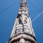
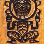
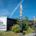
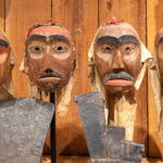
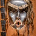
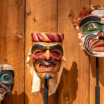
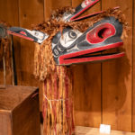
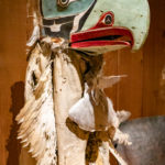
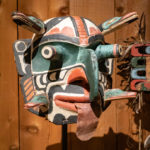
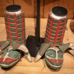
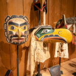
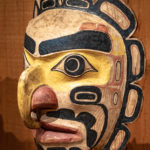
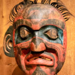
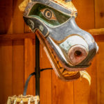
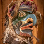
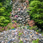
As we left the Park walking toward the village we came upon the World’s largest Totem Pole, at 173 feet tall. The wooden tribal totem pole was built from two sections, one 163 feet tall and the other 10 feet. The figures on this totem pole represent the Sun Man, a whale, an old man, a wolf, the Thunderbird, a two- headed serpent, a bear holding a salmon, and a raven holding copper. It is supported by wires to hold it up and stands all on its own in a field near the museum.Then we visited the museum at the U’mista Cultural Center. In 1921, the BC Government confiscated many items including wooden masks, copper shields, and dance regalia in an effort to stop the potlatch custom of dance, song, and wealth. During the 1970s and 80s, the local First Nations regained their possessions, and the returned artifacts are housed in this museum. Up to half of the village’s residents are First Nations people. It is a fascinating place to visit to experience so many of their beautifully made artifacts.